Anable Cove Habitat Restoration
This proposal, although many years old, meets the objectives the community has been expressing in response to “YourLIC” presentations – water absorbing measures to address sea-level rise due to climate change, a natural area equitably accessible to all neighboring communities, open space ample enough to finally improve the deficit ratio (not make it worse) and in conjunction with the DOE building provide environmental education and training at all levels serving the entire community.
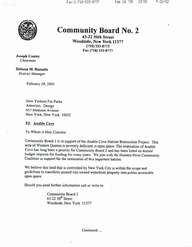
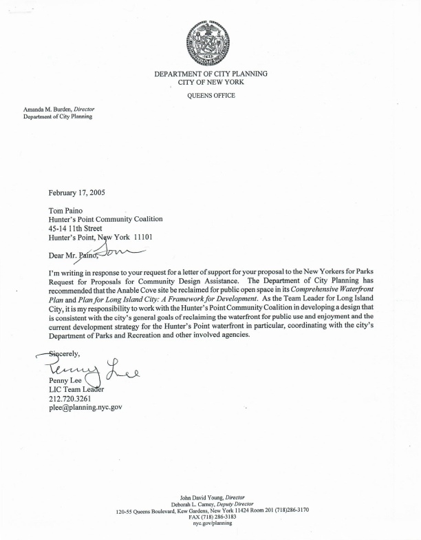
With regard to the current debate, this collection of documents can illustrate how both “YourLIC” and Economic Development Corporation have ignored the community in their zeal to meet only the demands of the developers. The Anable Cove Habitat Restoration was on CB2’s “Statement of Needs” list for well
over a decade. The entities supposedly working on our behalf do not even make mention of it.
Public land for public use!
Anable Cove Habitat Restoration Project
Statement
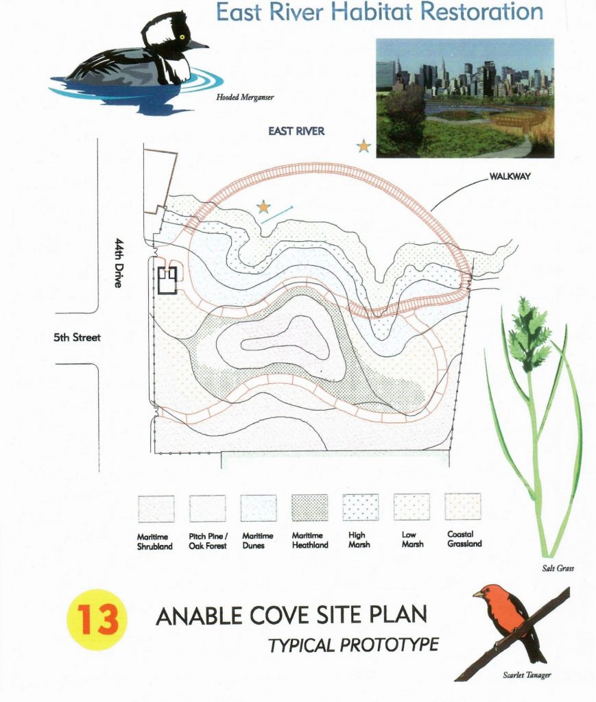
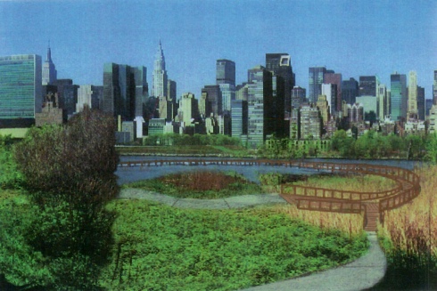
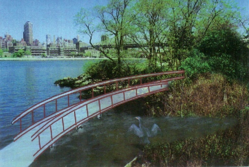
The Anable Cove habitat restoration project is a proposal to transform an unused city-owned, waterfront property into a publically accessible refuge accommodating the natural ecology of the East River and its potential wildlife activity. The proposed plan calls for preparation of the site to receive plant species native to briny tidal wetlands, the creation of walkways, (both on land and over water) and the construction of a facility kiosk. The plan was initiated by the Hunters Point Community Coalition (a local, not for profit, neighborhood preservation organization) and would be executed by the New York City
Parks Department.
Description
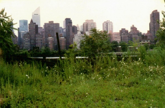
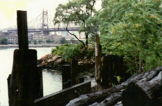
The site is a 3 ½ acre parcel housing a pile-supported river-side platform with shipping structure and temporary metal shacks, that was formerly the Ports and Terminals pole storage facility. It is currently under the control of the Department of Citywide Administrative Services (DCAS) and has not been in use for at least 10 years. It appears on Community Board 2’s “Statement of Needs” list as a publically accessible natural habitat. The site provides an excellent opportunity to show that natural habitat can coexist with very dense human activity. Property on both sides has been rezoned for high density
residential development. Immediately adjacent is the 44 Drive “fishing” pier. Just to the north, an outcropping of land provides a natural buffer to tidal currents and boat wakes creating a haven for tidal wetland ecology. The absence of human activity has already allowed the presence of blue claw crab, some marshland grasses and an occasional heron. The proposal would foster this nascent natural habitat by undergoing a planting program sensitive to the needs of wildlife. It would include low and high marsh grasses, maritime species and upland shrub/tree forest. The walkways would be a natural material under the guidelines of handicap accessibility. The kiosk facility would be unobtrusive and house a toilet and space for interpretive information.
Relevance
At 3 ½ acres, Anable Cove will not be a major wildlife refuge. However, it lies directly in the path of the Atlantic flyway for migratory birds and insects and therefore a critical spot for rest and nourishment. Furthermore, fostering a succession of permanent habitat, could bring back species that originally resided here, such a~ oysters. The plant life acts as a natural cleanser to the river helping to abate the effects of pollutants draining into it. The restoration could play a major role in helping to meet the agreements between Connecticut and New York for bringing back the health of Long Island Sound. Most important, this habitat would be the first of its kind in the inner city and may be the only opportunity for some city residents to learn the importance of environmental protection. Equally relevant, this open space will act as a balance and enhancer to the intense development planned for the water front. It will connect to an esplanade at both ends and improve neighborhood quality of life resulting in direct benefits to proposed development.